Big Chiwaukum WA
July 2nd, 2025
Hi, we're the Mountain Goats (Terrence), and Yesterday I solo climbed Big Chiwaukum. I see some reports that the route up was snow-free, so I decided to give it a shot. Things started terribly as a tree fell onto the road, most likely from the night before, 2.5 miles from the trailhead. There was no way for us to drive over it or move it, so I parked my car behind the tree and got moving.
2.5 miles later and 600 vertical feet higher, I got to the trailhead. (When talking about the trail, I'm not going to include the extra 2.5 miles I had to go). The trail starts by following White Pine Creek heading Southeast through the valley. The first 2.5 miles are just a series of ups and downs as you slowly ascend above the creek.
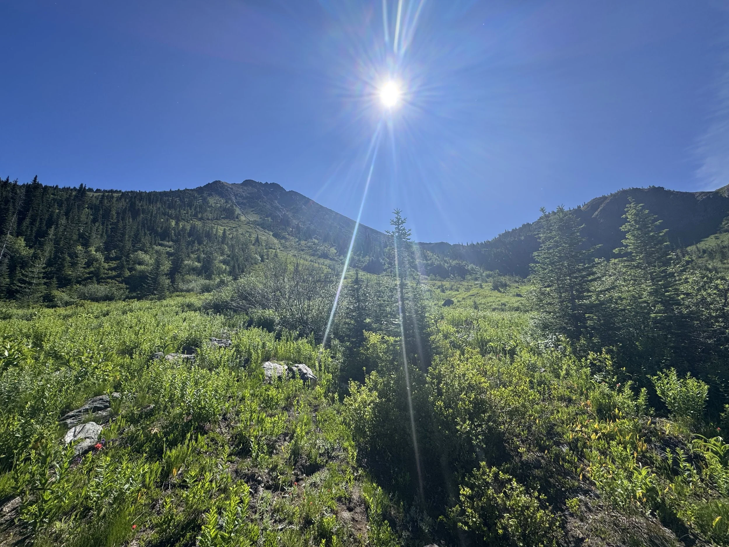
2.5 Miles on the trail splits, and you leave the valley behind as you ascend the ridge heading south. After a series of short, steep switchbacks, you'll be at 4000 feet. The trail then straightens as you continue to ascend the ridge heading south, this part of the trail takes you to the top of the ridge (5000 feet. You're rewarded with some views across the valley (Stevens Pass) on the way up, and even at the top of the ridge, you still haven't broken out yet. You get a fleeting glimpse of North and Middle Chiwaukum before you head back into the woods.
The trail flattens and slightly changes directions, heading more Southeast as you get off the ridge and into the valley above you. At around 5,300 feet, the trail splits, one going to the upper meadows and Big Chiwaukum and the other going to Grace Lakes and then Big Chiwaukum. I took the first route. At this point, I was almost 9 Miles in and took a needed first break of the day. Unfortunately, the mosquitoes were beyond awful and started smarming me even with bug spray.
Finally broke out
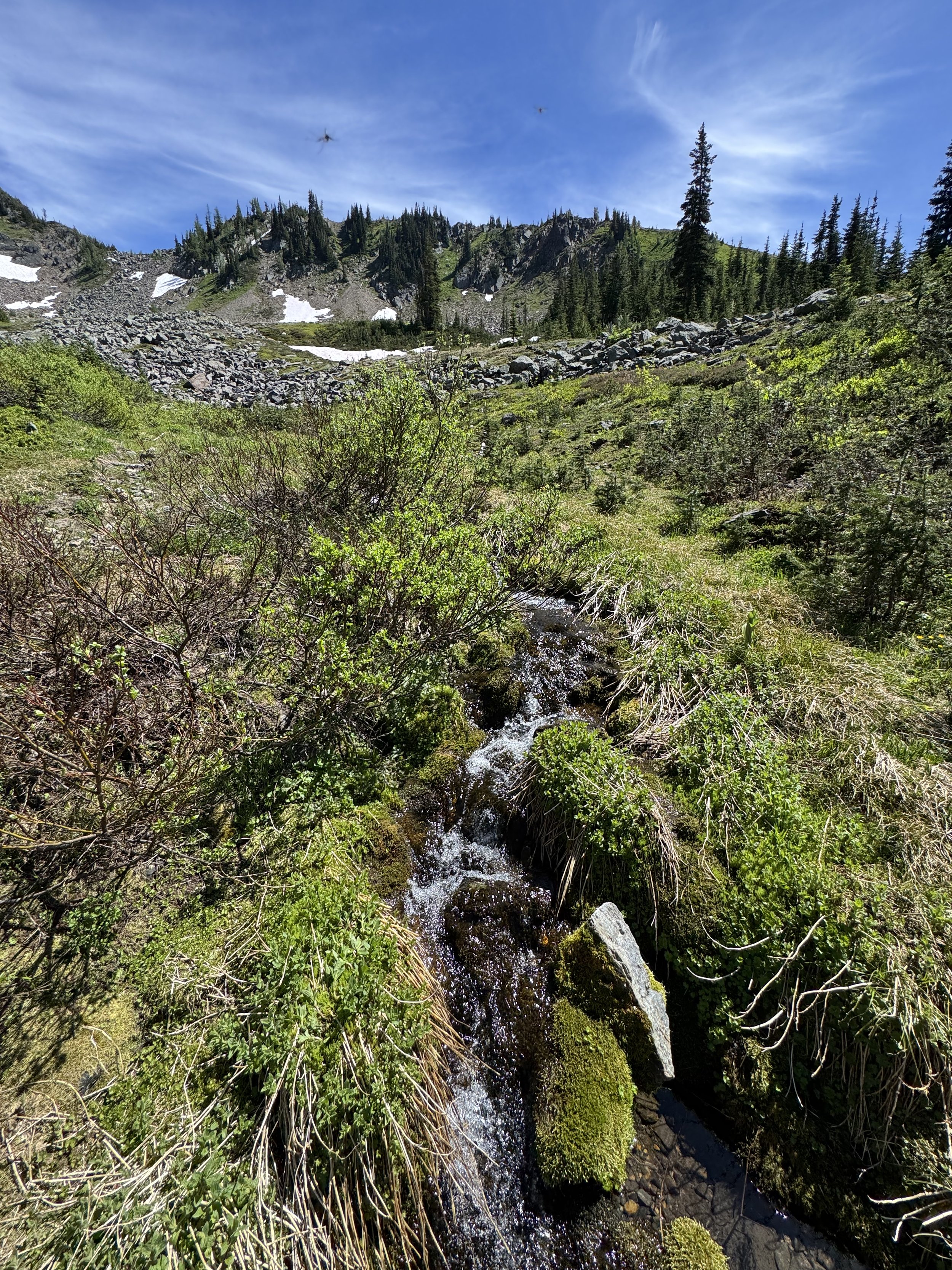
Last water source
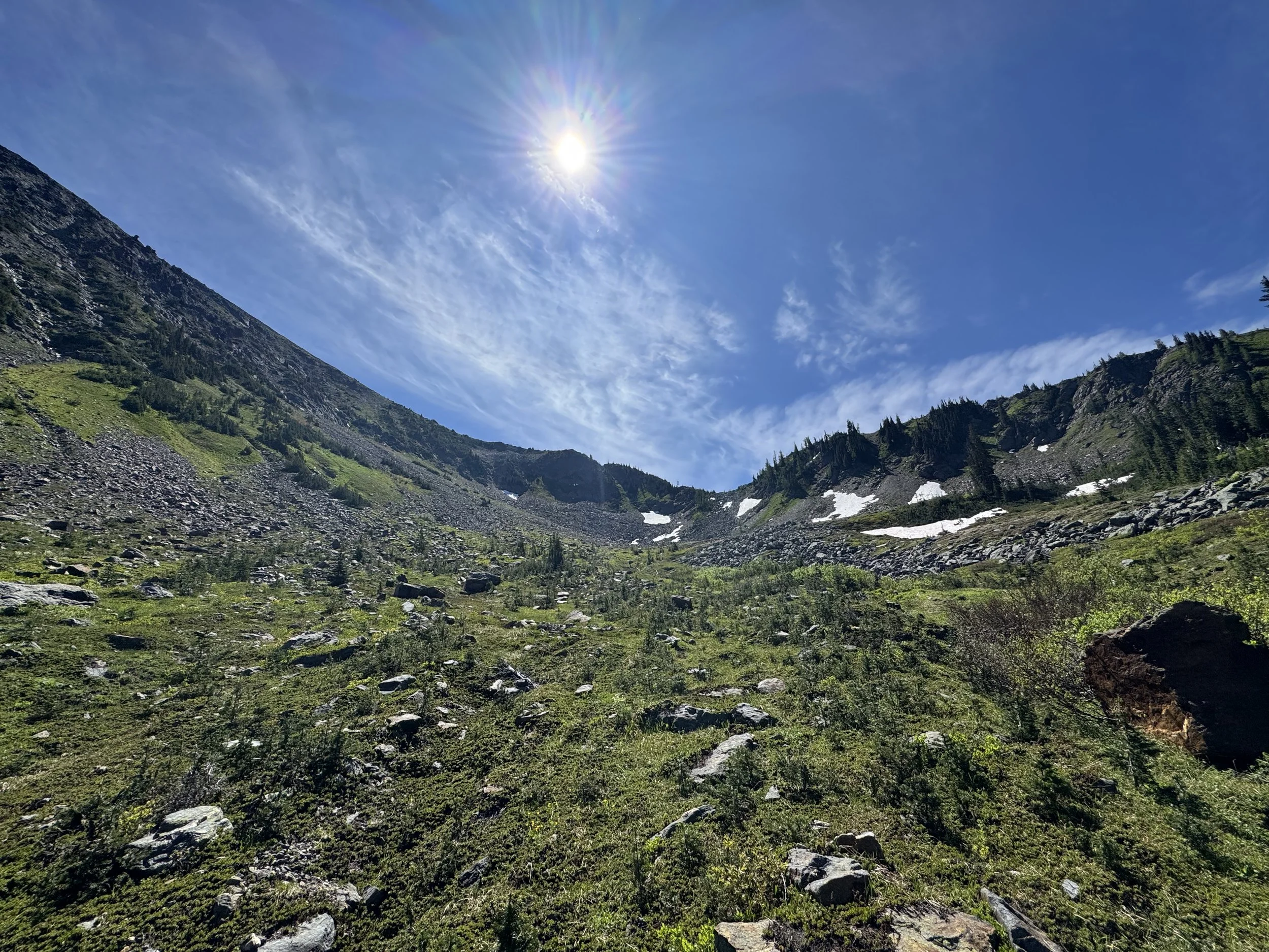
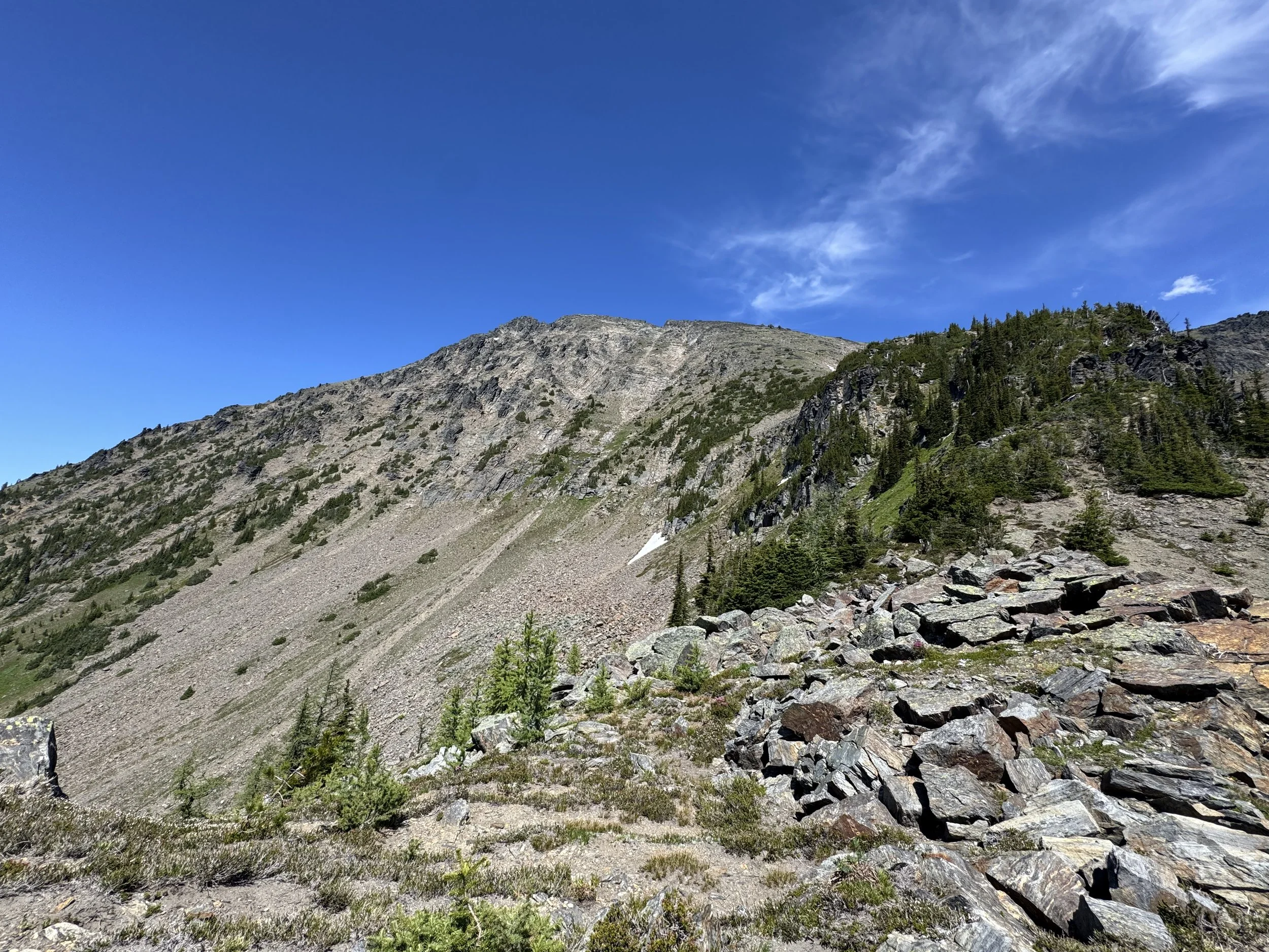
Looking up towards the cliff band
I then followed the climbers' trail Southeast up to 5,600 feet, at the point the "trail" continues to head Southeast steeply, traversing below a cliff band before steeply ascending the hillside to the right of it. I didn't see a trail and heading Northeast above the cliff band and traversing back Southeast towards the trail seemed like the more optimal route. After trying the "correct route" on the way down, I much preferred my impromptu route. Once above the cliff band, Big Chiwaukum and the route up to its ridge are fully in view. At this point, I needed water, so I headed over to a stream around 6,150 feet. This is the last water source on the route, so use it!
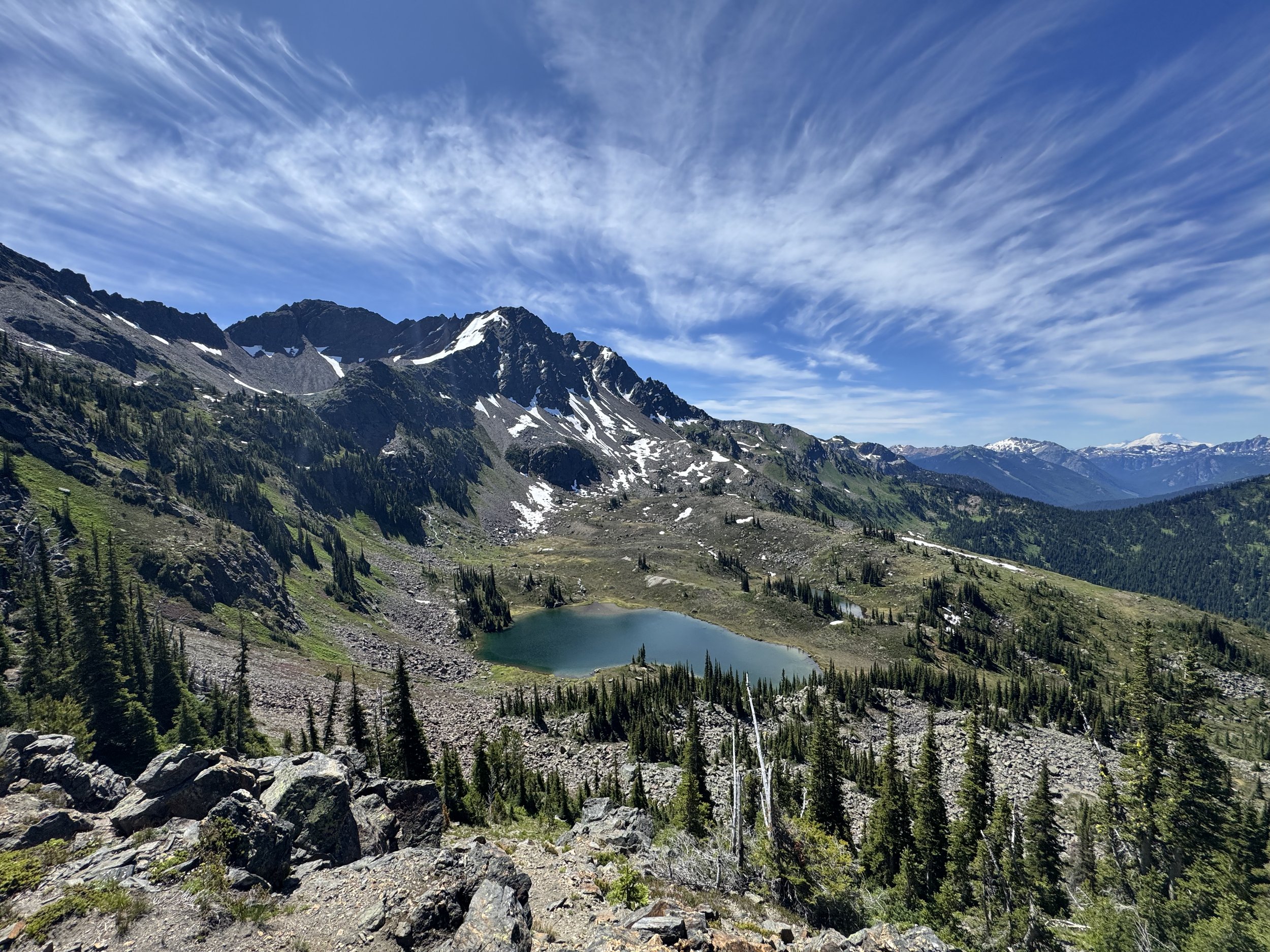
The route then makes a beeline towards the ridge, ascends the smaller boulder field, and check your GPS to make sure you're taking the right one. Once on top of the boulder field, you've made it to the lower ridgeline of Big Chiwaukum. Grace Lakes sits below you, Chiwaukum sits above you, and in the distance sits Rainier. The trail from here is pretty easy to follow as you snake up the ridge, past a cliffy area, before beginning to head straight up, slightly veering Northeast.
On the ridgeline
At around 7,100 feet, I lost the trail, but they continued to head up, doing my best to head NE. Before I knew it, I was at 7,800 feet and took a hard left heading Northwest. Unfortunately, I got a bit excited and didn't check the GPS.. I ascended what I thought was the summit, but it was the false summit, which cliffed out right before the true summit. This led to some class 4 downclimbing and crossing a pretty exposed chute. The actual right bypasses the chute by dropping below it and traversing. Luckily, I was able to find a solid ledge and met up with the trail 40 feet below the summit. From there, it was a breeze to the top. Just for reference, when you're traversing over to the summit at around 7,800', don't ascend the ridge, stay low and follow the cairns past the chute and up a ledge before turning back NE to the true summit.
Looking towards the summit
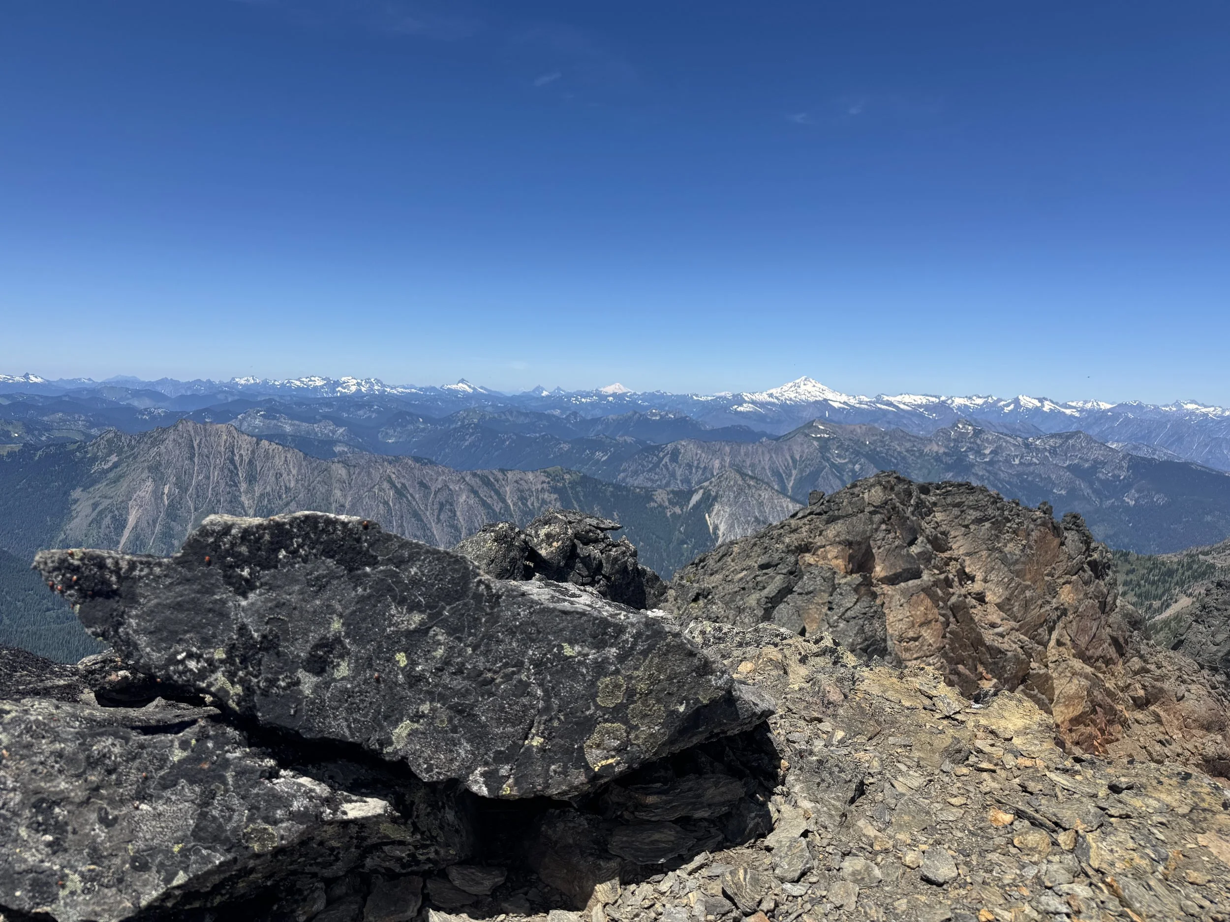
Summit View
Only one up here
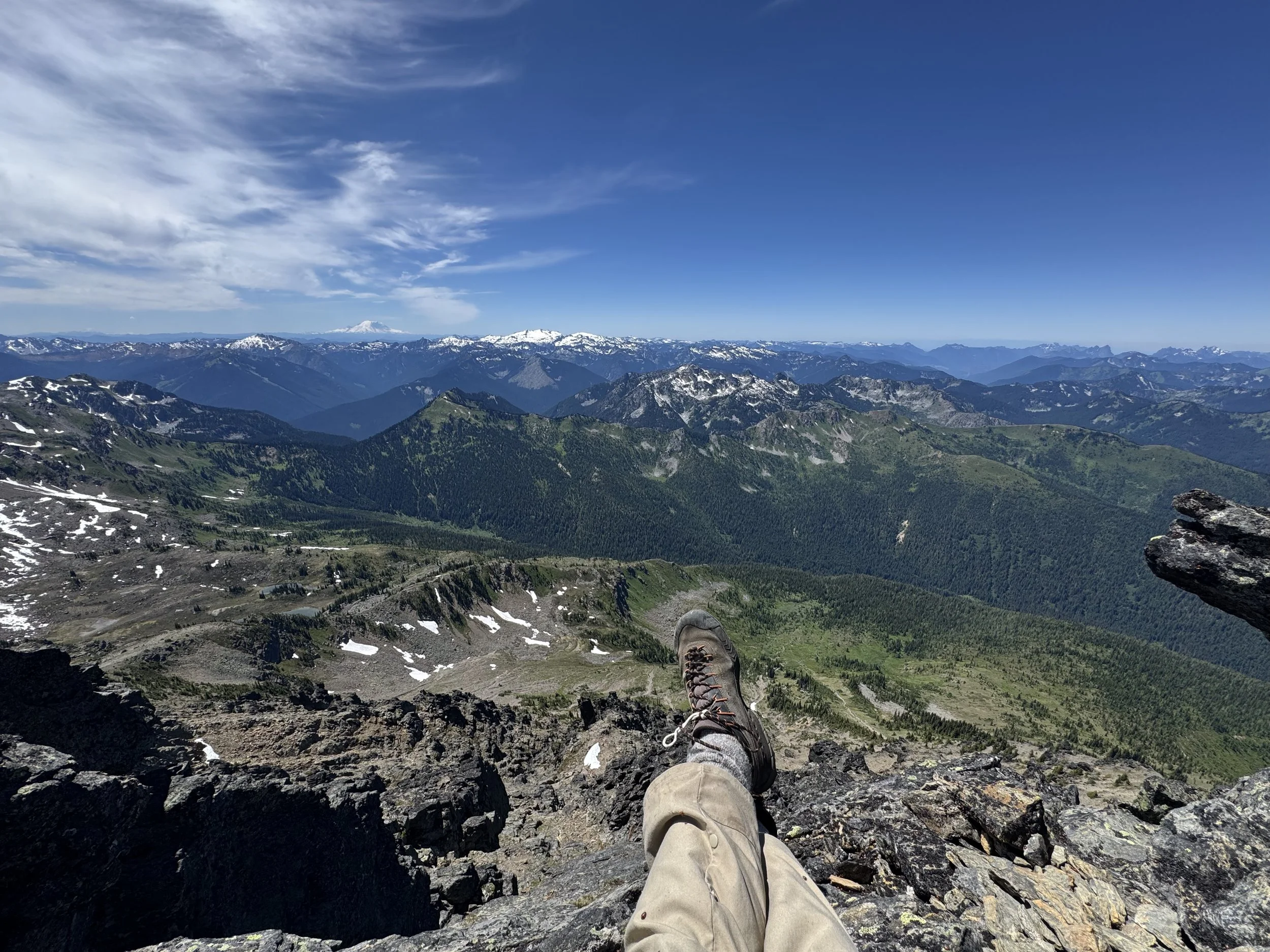
The view from the top is beyond stunning. Big Chiwaukum's prominence creates legit 360-degree views. I saw Baker, Adams, Ranier, Glacier, Stuart, Sloan, and so much more. I got the whole summit to myself, well, not quite myself, I shared the summit with 1000s of ladybugs. At this point, I was over 10.5 miles from my car.
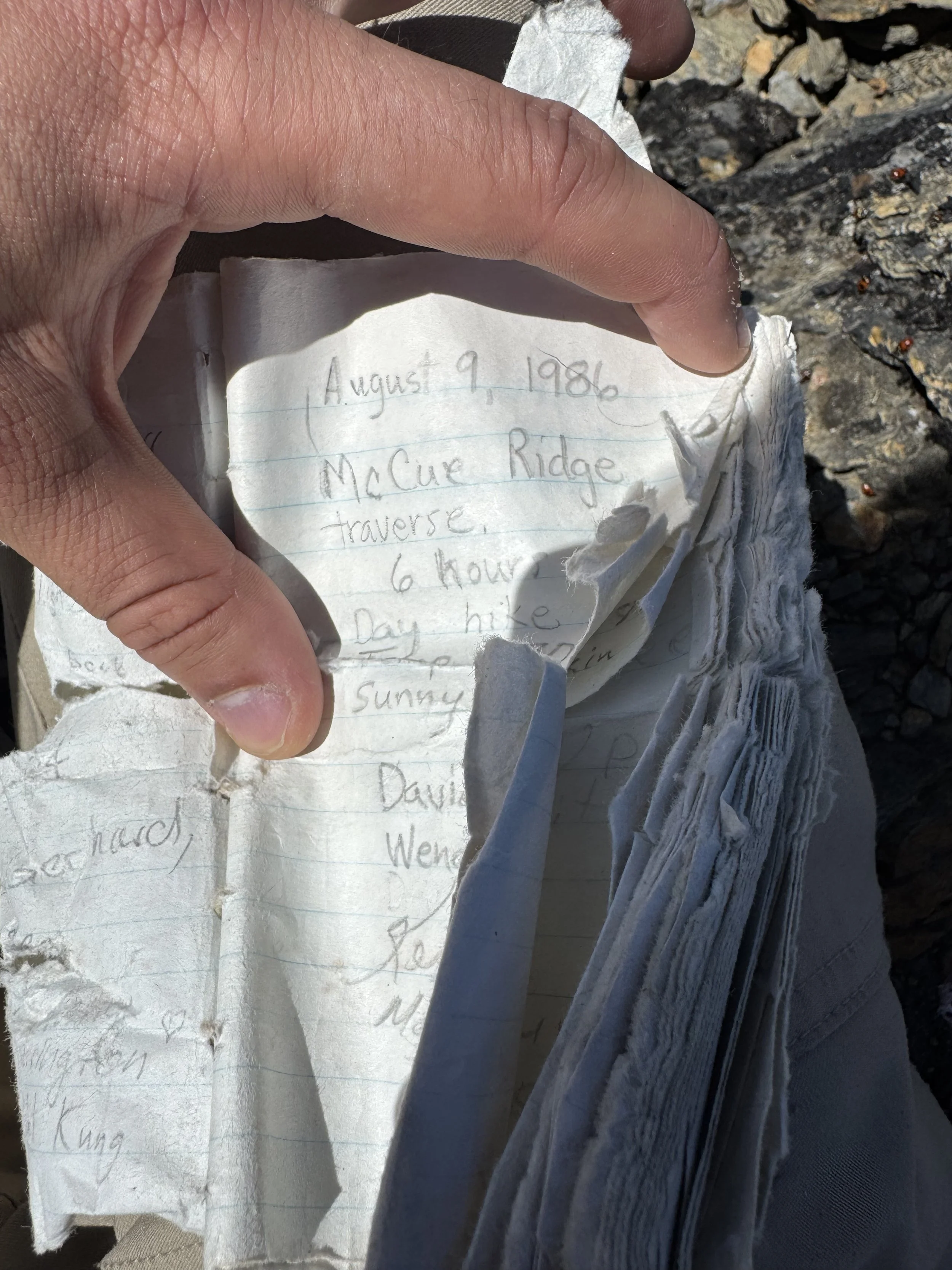
86’ pretty awesome
The journey down sucked, nothing more. I got back to the car 11 hours and 20 minutes after leaving it. And low and behold, some kind Samaritan sawed up the tree and got it off the road.
Overall, this is an awesome hike; the extra 5 miles just made it a bit long for me. The fact that an 8100-foot peak is snow-free in July is awesome, and this would be a great training hike for Baker, Adams, or Rainier. According to the data, this climb has been snow-free since early June. Like always, stay safe and Happy Hiking!
Finals Stats: 21.5 Miles - 5,900 Elev Gain - 11:20
My stats if I made it to the TH: 16.5 Miles - 5,300 Elev Gain - 9:50